As the elephants of Senyati decided to move on, we decided to do the same. Passing briefly through Namibia’s Zambesi Region (formally Caprivi Strip), we found ourselves at the Namibia/Zambia boarder at Katima Mulilo. We braced ourselves for a lengthy stay at the border, only to find out that it was a breeze. Friendly people, lots of Bundesliga smalltalk and well prepared papers for the Cruiser got us through in 1,5 hours. Zambia, here we come!
Our first stop brought us to Sioma Camp, a nice place on the banks of the Zambezi River. We met Daniel the owner back in Katima and he promised white sand dunes and a lovely view. He was 110% right. Ngonye Falls was our first destination for the next day. „Take a guide or you will get lost.“ – well, at first we could not even find the falls at all… But then a nice guy who was guarding the Ngonye Community Park got his rifle (????) and jumped on the side steps of the Cruiser and guided us through to the falls. We watched Giant Kingfisher in action, the water flowing down Ngonye Falls and enjoyed the cool mist that came over from the falls. The (????) never got explained, so I can’t add a cool story to this detail.

Going north towards Mongu got us reading on the Lozi people, who live with the water and who are always on the move in the Barotse flood plains. Stocking up at Mongu’s Shoprite was easy, getting cash out of the only two working ATMs in all of Western Zambia not so much. Thanks to FNB – we managed with this card (don’t get me talking on the fees …)
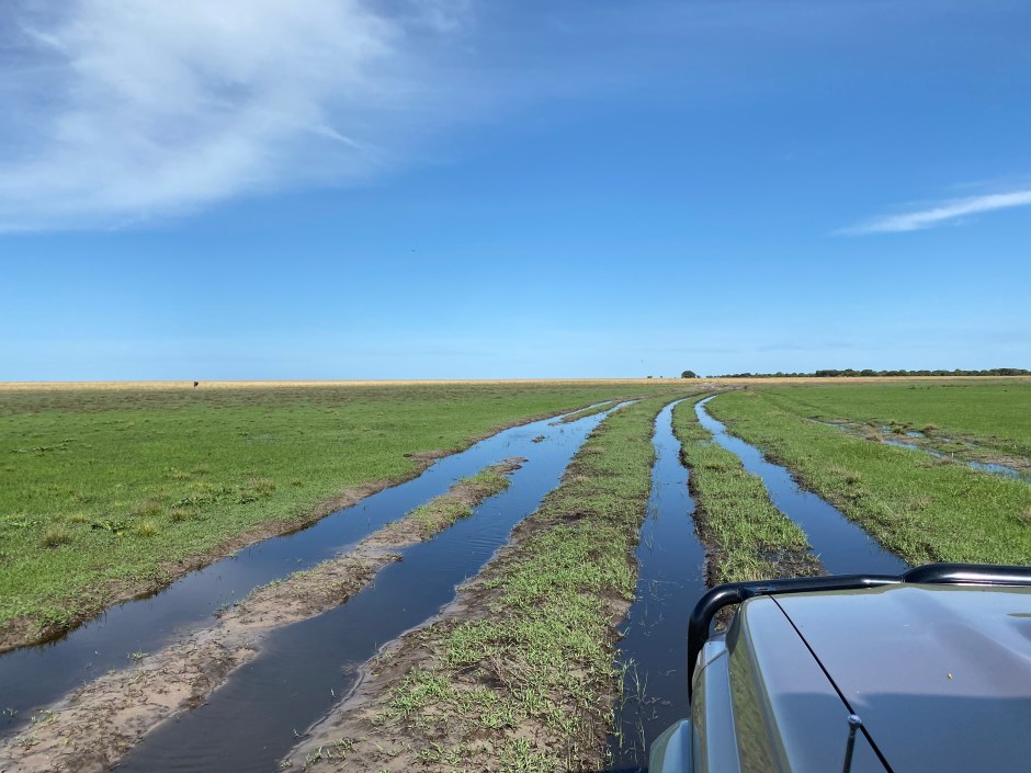
Liuwa Plains National Park across the Barotse flood plains was next. Going over the flood plains was difficult in the past, now they have built bridges and a good road, for half the way that is. The other half to Kalabo was one big pothole …
A ponton crossing later we found the Cruiser going on deep sandy tracks towards Kwale Camp. 40 minutes drive turned out to be close to 2 hours, Liuwa has lots of space as we have discovered, but far too less signs! And for the first time ever, Tracks 4 Africa and OsmAnd did not get us to where we wanted (and needed) to be. Quite shocking at first, but then also really adventurous.
We explored the main areas of the Liuwa Plains NP, the Sausage Tree, Kings Pool and Lone Palm. In an open plain, the trees is what you look out for! We saw hundreds of wildebeest and also Lechwe; we heard that there are lions and cheetahs, but we only encountered the BBC film crew that films them. Not nearly as inspiring …
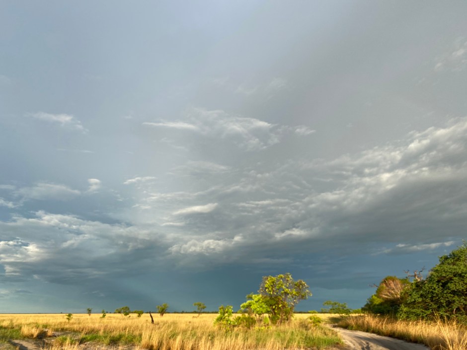
We left Liuwa amazed and with the knowledge that there are still places that are not properly covered with a GPS. Nice feeling!
Back on the main road, we now go further east. Kafue is up next, still west and still wild!
/
Die Elefanten sind in Senyati nicht mehr aufgetaucht, daher haben wir beschlossen, auch weiterzuziehen. Ein kurzer Abstecher nach Namibia in die Zambezi Region (früher Caprivi Streifen) brachte uns an die Grenze zu Sambia. In einem netten Café in Katima Mulilo haben wir uns für den Aufenthalt an der Grenze gestärkt, nur um dann dank freundlichen Zollbeamten, Bundesliga Smalltalk und gut vorsortierten Papieren für den Cruiser nach 1,5 Stunden durch zu sein. Sambia, los geht’s!
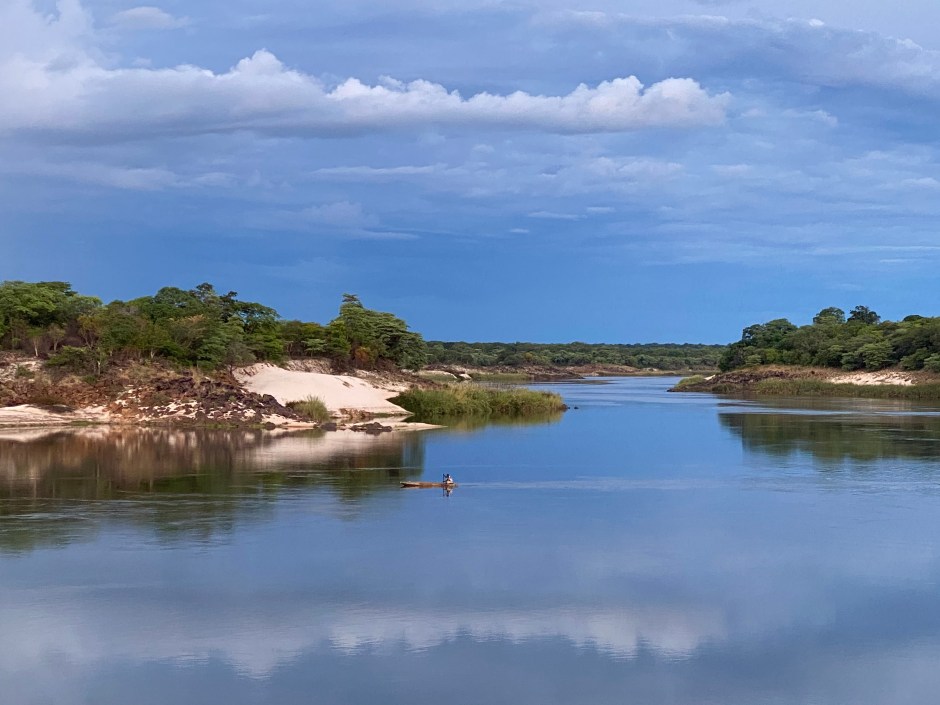
Der erste Stop lag am Sambesi, im Sioma Camp. Daniel, den Besitzer hatten wir im Café in Katima Mulilo getroffen, er versprach einen tollen Ausblick auf den Fluss und weiße Sanddünen. Wir wurden nicht enttäuscht! Die nicht weit entfernten Ngonye Wasserfälle standen dann auf dem Programm. Ohne Guide geht nichts wurde uns gesagt – haben wir geglaubt, mussten aber erst einmal den Park an sich finden 🙂 An den Wasserfällen angekommen (sehr nah dran, Geländer gibt es nicht …) haben wir Wasservögel beobachtet und den kühlen Sprühnebel der Wasserfälle genossen.
Im Norden liegt Mongu und die Barotse Überflutungsgebiete. Die Lozi, die Bewohner der Barotse Gebiete, leben seit jeher mit dem kommenden und gehenden Wasser. In einer guten Regenzeit stehen 17 Mrd. Kubikmeter Wasser in der 250 km langen und bis zu 50km breiten Flutebene. Die Lozi sind daher ständig am Umziehen, der Prinz hat einen Trocken- und einen Überflutungs-Palast …
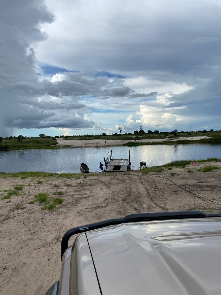
Auf einem Ponton ging es zum Liuwa Plains Nationalpark. Liuwa ist eine riesige Ebene, die in der Regenzeit für Monate unter Wasser steht. Bereits jetzt waren erste Fahrrinnen voll Wasser … vorher sammeln sich 40 000 Gnus und begeben sich dann auf den Weg nach Angola, einen Teil davon haben wir gesehen – sehr beeindruckend!
Weite ist ja an sich nicht das Problem, fehlende Beschilderung schon. Viele Fahrrinnen führen irgendwo hin, wir mussten aber zum Kwale Camp. Das haben wir dann pünktlich zum Sonnenuntergang auch gefunden – sehr schön war es da! Unser Campingplatz unter Bäumen nahe der Ebene …

Liuwa Plains ist leer, die Routenpunkte bilden meist höhere Bäume – und sie heißen „Leberwurstbaum“ oder auch „einsame Palme“. Von weitem sichtbar und gute Rastpunkte. Trotzdem kamen 2 Navigationsgeräte an ihre Grenzen. Es soll noch einmal jemand sagen, dass jeder Track kartografiert ist … und das man seinen eigenen Weg nicht fahren kann. Ob man das darf, ist natürlich eine andere Frage!
Die Löwen und Geparden von Liuwa haben wir nicht entdeckt, ein BBC Filmteam allerdings schon. Die filmen die Geparden – sagen wir es so: die Geparden hätte ich viel lieber getroffen!
Nächster Halt ist der Kafue Nationalpark, immer noch westlich von Lusaka und immer noch sehr wild!

